Monday, March 31, 2008

Trail Poetry

The beauty of nature has always been a great inspiation to poets, and aspiring poets. Sometimes trail poetry is found on the pages of a visitor's book, or scribbled on the back of a sign. Sometimes it is unfortunately carved into a wall or even a tree.

Since not everyone recognizes their own talents (or lack thereof) a whole lot of trail poetry is just plain bad. But once in a while there's a real gem.

The Fiordland Visitor Centre in Te Anau features an anonymous poem, written by someone who must have had a similar experience to my own on the Milford Track. I've reprinted it here for your enjoyment.

It rained and rained and rained and rained
The average fall was well maintained
And when the tracks were simply bogs
It started raining cats and dogs.

After a drought of half an hour
We had a most refreshing shower
And then most curious thing of all
A gentle rain began to fall.

Next day was also fairly dry
Save for a deluge from the sky
Which wetted the party to the skin
And after that the rain set in.

A Fiordland Tramper
1984

Thursday, March 27, 2008

Now in Glorious Technicolour

For those who have been patiently waiting, there are now photos on all of my trip reports from the past few weeks. So feel free to enjoy these posts again, with visual accompaniment:


Enjoy!

Tuesday, March 25, 2008

Happy Belated Valentine's Day

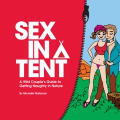
The Seattle Times gave me a wonderful gift on Valentine's Day by publishing this article about "Sex in a Tent" by Terry Woods.

Being on the road, I didn't get around to linking to the article at the time. So here is the long overdue link!

Queen Charlotte Track - Marlborough Sounds

For the final tramp of our trip, we were planning to do a few days in the Richmond Ranges, towards the north end of the island. But after buying some maps and staring blankly at them for a while, we were unable to find a suitable route. We knew little about the area - OK, we knew nothing about the area - which made it almost impossible to judge the difficulty or accessibility of any of the tracks. So eventually we just abandoned the idea, and decided to go somewhere else.

I suggested we do the Queen Charlotte Track, at the very north end of the South Island, in the scenic Marlborough Sounds. We had not planned to do it on this trip, because it is reasonably easy to reach from Wellington, so we could do it another time. But since we had nothing else planned, I figured - why not?

The Queen Charlotte is considered a walkway, as opposed to a tramping track. This means that it is designed for those with little or no wilderness skills or experience. So we figured it would be an easy, relaxing way to end our trip. But being a last-minute decision, we hadn't really looked into the details. We randomly decided to spend 4 days doing the 3-5 day trip, without having first checked on details like, say, the distance. So we were a little surprised to see that it was 71km long - that's longer than our 5-day trek on the St. James Walkway! In order to complete it in 4 days, we would have to walk an average of 18km per day. That's pretty far for us, with full packs on. But we figured it must be such easy terrain that it wouldn't be a problem.

Because the track follows a long peninsula, you have to arrange for water transport either to or from the far end. We chose to start at the far end, and make our way back to the head of Queen Charlotte Sound. The water taxi is quite expensive, at $80 per person for a drop off at one end of the track, and pick up at the other end.

There are five Dept. of Conservation campsites along the track (no huts though), and a few private ones. The track is very popular because there are also a range of other accommodation options, ranging from budget hostels to fancy resorts. So lots of people stay in comfortable rooms with hot showers and restaurant meals while they experience the walkway. One of the other convenient features of the track is that you can arrange to have your pack (or suitcase I suppose) transferred to your next overnight stop by boat, so that you can walk with only a day pack. Both resort-stayers and campers tend to use this service, which makes walking longer distances easier and more pleasant.

But being gluttons for punishment, we opted to carry our big, heavy packs the whole way. Why? Ostensibly so that we weren't tied to any specific destination on a given day. But really, I can't think of any good reason why we did it. If I did the track again, I'd certainly opt for the pack transfer service. It was the same price as the water taxi with no pack transfers, so why the hell not!

On our first day we were dropped off at Ship Cove, where Captain Cook based his New Zealand exploratory voyages in the 1700s. There was a monument, and some cannons on display. More importantly, there were toilets to use before we started the track!

Right away we were headed uphill. That first climb let us know that we were not in for an easy four days. Not relaxing, anyway! And without huts to sleep in, we were also carrying our tent, which added a couple of extra kilos to G's load, and he was feeling it! But up we went, and back down again, all in our first hour. At least it was a bit windy, so we stayed reasonably cool. The walkway was also clear and well benched, with switchbacks up the hill. So not exactly tough to negotiate, just a matter of slogging it out.

The first campsite is only about an hour along the track, so really not much use. But the second DoC campsite it another 7 hours away, and we had only started walking at 11:30am. Who planned these things? Luckily, there was a private campground about 5 hours from the end of the track, so we carried on to there.

The place is called Miners Camp, because it's at the junction of a side trail that leads to an old mining operation. It's really just some guy's house (there are private properties all along the Queen Charlotte Track, mostly vacation homes and farms) where he lets people camp in the yard for $10. He has an impressive collection of fruit trees and vines as well, including kiwifruit, apples, peaches, figs, olives, and tamarillos. He also had the most unusual outhouse set up for campers. It had a combination lock on the door, and inside was a flush toilet and a small sink. The door had a cat-flap on the bottom for some reason. And sitting beside the toilet was a visitor's book!

The next day the skies were clear and the wind had died, so it was a hot one. We started off easy, with a flat section of the track following the water's edge. We stopped of a snack at a picnic table, and a local weka (a brown, chubby, flightless bird native to NZ) came out to see if he could scrounge any food from us. Obviously they have gotten used to the large number of people passing by along the walkway. After passing the next DoC campsite we started uphill again. It was a three-hour trek to the next campsite at that point, but G had come up with the bright idea of trying to make it to the following campsite instead. Our current plan had us putting in an 8-hour day on our last leg, to meet the 4:30 water taxi. But G figured if we did a longer day now, we'd be able to have an easier last day, just 4 hours of walking.

I was not convinced of this plan, but I said I'd see how I felt at the first campsite, and what time we arrived, and then we'd decide for sure. Meanwhile, we made our way up to the ridgeline, where the views over the Marlborough Sounds were lovely, but the sun was brutal.
We continued along the ridge to the first campground, above Bay of Many Coves. Here we had another snack and a rest, while I tried to decide whether I could continue. Meanwhile, two more wekas came by to see if they could share our snacks. One of them seemed fairly interested in eating G's hat if nothing else was offered. But G caved in and gave them some peanuts, which I hope are not harmful to birds! It was coming up on 3:30, and the next campground was 3 hours away. Decision time. I figured I was still feeling OK, and since G was so keen on this plan I'd try to make it work. We continued on.
The track stayed up on the ridge, rising and falling with the contours of the land. It was a long, tiring walk and by the time we arrived I was more than done. My legs and feet were aching, my shoulders were sore and stiff, and I was more tired than I've been in a very long time. And no wonder - I did some quick calculating and realised that we'd covered over 30km of track in one day! That is by far the longest walk I've ever done with a pack on, and one I'm in no hurry to repeat.

The campground was small and basic, with a cooking shelter and a tank full of stream water. G put up the tent while I got dinner ready. By the time we had finished dinner, we were almost ready to crawl into bed! I did manage to stay outside long enough to take sunset pictures.
The next morning we were both a bit sore and uninspired. The first couple of hours were mainly downhill, meeting up with a road at Torea Saddle. Just down the road are a few accommodations and shops, at a place called Portage. We decided to go down and see if we could get a cold drink or something at the shops as a treat.

We ended up at the Portage Resort cafe, where they had some wonderful Kapiti ice cream for sale. We each had a double scoop, and enjoyed every well-earned lick! The resort looked quite nice, and even had a little swimming pool right beside the bay (in case you don't like salt water I guess.) But the walk back up to the track was 20 minutes uphill in the sun, and our relaxation had worn off by the time we got back to our day's tramping.
A big climb dominated our day (about 400 metres up, then down about half way and then up another 300 metres), and it was another scorcher. The summer weather would have been welcome in another situation, but lugging our packs along the trail we were hoping for a breeze or some clouds to cool things off. No such luck. As a result, what should have been a fairly moderate day (about 6 hours) was hot and sweaty. And of course, we were a bit worn out from our big day before.

Our stop for the night was a private campground at Mistletoe Bay. This involved an uncomfortable 20-minute walk down a side trail over lots of tree roots and such. We'd been so spoiled by the cleared, benched walkway that an actual tramping track seemed like a big challenge.

The campground was actually accessible by both boat and road, as it turned out. There were campervans parked all around the place. We found a spot and set up the tent. The toilet block featured not only flush toilets but also hot showers! Unfortunately, they were in the middle of a water shortage, so they had set the coin-operated showers for a measly one minute. Not worth it! Instead, I decided to go for a swim in the bay, which was cool getting in, but quite nice. The campground also had a kitchen, so we were able to cook without our camping stove, and even chill our drinking water in a fridge - luxury!

There were a lot of ducks at the campground, harassing the campers whenever they had food out. There was also one lone pukeko, grubbing about in the grass. They are the funniest birds to watch - those feet are just huge!

The next morning we found another trail to take up to the main track, this one much more clear and easy. Another hot, sunny day followed, but much of the track was in the shade. Getting near to the start of the track, we encountered more hikers and mountain bikers (the whole track is bikeable, but half is closed to cyclists from December to February) along the way. We finally reached the end of the road around 2pm, and decided to dry the tent out while waiting for our 4:30 water taxi.

An enterprising young woman had a caravan set up by the car park, where she sold drinks, ice cream and snacks to the walkers and cyclists. We found it impossible to resist an ice cream.

After the long wait, we were happy to see our water taxi arrive on time. But the adventure was not yet over. After loading up all of the passengers and gear, the engine on the boat died (apparently a problem with the water pump) and we weren't going anywhere! The skipper called for help, and it took over an hour for the larger boat to arrive and pick us up, towing the other boat back to Picton behind us.

The Queen Charlotte Track was hardly a "wilderness" experience, but the scenery is lovely, the walking is straightforward, and this makes it accessible to almost anyone. This is especially true because you don't have to carry your gear everywhere with you, and you can use the water taxis to make your tramp as long or as short as you like. Although we ended up putting more effort into it than we had anticipated, it was definitely a lovely way to wrap up our trip around the South Island.

Saturday, March 15, 2008

The St. James Walkway - Lewis Pass

Last week we walked the 5 day St. James Walkway, which begins and ends on the Lewis Pass highway, about 15 km apart. The walkway goes through parts of Lewis Pass Scenic Reserve, Lake Sumner Forest Park, and a private cattle farm called St. James Station. It's rated as an easy tramp, which sounded nice to us as the weeks of travelling and tramping begin to take their toll on our weary bodies!

In truth, the walkway is better set up as a 4 day tramp. Otherwise most of the days are really only half a day of walking, and you end up spending a lot of time sitting around the huts. A fairly fit tramper can easily do it in 2 long days and one short day.

However, we were taking the leisurely option and going for 5 days. While I waited at the trailhead shelter for G to do the car shuttle, I watched the rain falling and felt my enthusiasm wane. I'd had quite enough of walking in the rain down in Fiordland, and was hoping for better luck up here. But by the time we got going, the rain had slowed to a drizzle, and soon stopped completely.

The first day's walk took us down into Cannibal Gorge, through lush, beech forest and mossy ground. It was relatively easy going, with no steep climbs or descents. In fact, there is not much altitude change over the entire track, with the majority of it following river valleys, and a couple of low passes connecting them.
A few hours in we passed Cannibal Gorge Hut, but continued on to the next hut, Ada Pass Hut. It was chilly there by late afternoon, so G set himself the task of getting the coal stove burning. At first the hut filled with smoke, and we got even colder opening all of the windows and doors to clear the air. But eventually the fire settled in and the hut was cozy and warm. We shared it with an older woman from Germany, who had somehow misplaced her cutlery over lunch. So G gallantly gave her his plastic spoon, and resigned himself to eating with our wooden cooking spoon for the rest of the trip.
Day 2 took us into the St. James Station, so we were contending with cows and their droppings along the way. We went of Ada Pass, which is neither steep nor high, and then followed the river valley through mostly open flats until reaching Christopher Hut. We took our time, since the day's walk was only predicted to take 4.5 hours, and even with the slowest pace we could muster we arrived a bit ahead of that time. So we hung out at the hut, and were eventually joined by a young Scot named Thomas who was walking the track in the opposite direction. He has been living in Blenheim, working for the vineyards. This hut was out in the open, so it got more sun and a fire was not needed.
Day 3 was another short jaunt along the river. The cows on this station were very jittery. I guess I would be too, if I had some inkling that I was destined to become a steak dinner. But it was sometimes unnerving as they stared us down on the track, unsure whether they would bolt away, or charge at us. It was particularly dicey when there were both bulls and calves around for them to protect. However, we carried on without incident, giving a wide berth to the bulls. We also noticed that this track has a lot of birds along it. We saw fantails, robins, paradise ducks and a large population of Canada geese. It's funny, but those were the first Canada geese I've encountered since moving from Canada, and their off-key honking immediately reminded me of home! Sad but true, the annoying honk of the Canada goose is as much a sound of Canada and the plaintive cry of the loon, or the drunken roar of the hockey fans. But I digress...
The track itself stayed mostly in the open, crossing small streams but otherwise easy and quite flat. The next hut was Anne Hut, equipped with an emergency radio as it's about half way around the track. Luckily we were not having an emergency, and in fact we found we had the whole 20-bunk hut to ourselves that night. Woo-hoo! Clearly this track doesn't see much action outside of the peak holiday season. It's walked mainly by Kiwis, so while many of the more tourist-oriented routes we'd taken on this trip were still busy, this one was already quiet. Unfortunately, we seemed to be running a bit low on gas, having taken 2 partly-used canisters with us. So we lit a fire in the stove, and used it to pre-heat our cooking water for dinner.

The 4th day is meant to be the big one. 7 hours is the allotted time, including the conquering of Anne Saddle. In truth, the saddle rises only a couple hundred metres above the valley. There were some other places where the track rose nearly as high, just to get over a bluff. We met up with a group of young bulls who actually ran alongside us for a while, trying to decide whether to take us on. Luckily they left us alone in the end. I'm becoming less and less fond of cows as this trip progresses.
We ended up arriving at the next hut, Boyle Flats Hut, after 5.5 hours. Behind the hut a bit was a lovely stream, full of mossy boulders. So we went for a short walk before retiring inside. Our gas supply held out for the evening, and we even had enough for hot tea at breakfast. Again, we were the only ones at the hut.

Our final day should have been a straightforward 4 hour walk out to the road. However, after crossing the Boyle River over a swing bridge and re-entering the bush, I got distracted (probably trying to avoid the mud) and somehow lost the track. I thought I was still on it, but didn't see any markers for a while, and eventually came out by the river bank, where there was still no indication of the track. Then I knew I'd messed up.
We knew that the track ran parallel to the river pretty much all of the way, crossing another bridge near the end. So G suggested we just follow the river until we reach the bridge. I was more in favour of backtracking to find where I lost the track, but we went along the river.

At one point I noticed a clearing in the trees above, so I suggested we climb up to see if the track had emerged from the trees there. However, there was still no sign of the track. I wanted to look a bit higher up in the bush, which G thought was a waste of time. But he humoured me, and we ended up walking across the clearing, which turned out to be a bog with more nasty cows on it. Bush-bashing our way up, we still couldn't see the track anywhere. I resigned myself to following the river again, and we retreated back across the bog, having wasted a good half hour.

Another hour or so later, we finally spotted some poles marking the track alongside the river. Hooray - back on the track! I swore to follow more diligently for the remainder of the day. Our misadventures, it seems, had put us about an hour behind schedule. But we made it to that bridge across the river and knew we were close to the end. The rest of the walk went smoothly, and the car was waiting for us at the road.

The St. James is not the most spectacular walk in New Zealand, but for those who are not ready to take on alpine ridges, river-bashing or steep climbs, it gives you the chance to get out there for several days, surrounded by mountains, and not feel overwhelmed. In fact, many Kiwis seem to use it as a good way to introduce their kids to tramping, some as young as four! And if you're a bird-lover, you'll enjoy the fact that this track's relaxed pace will give you time to stop and appreciate the bird life in the area. Even the Canada geese!
So we're down to our last week of the trip, and tomorrow it's off to the Queen Charlotte Track, tent camping for four days in the beautiful Marlborough Sounds.

Saturday, March 08, 2008

How do you say "up"?

There's a common belief that the Inuit people in northern Canada have something like 30 different words for snow, because it's so much a constant part of their lives. Well, I've discovered something similar in the world of tramping - there seem to be countless ways of expressing an uphill track.

For instance, if you are walking uphill for a several hours, on a constant but not incredibly steep track, it's called a "slog".

If the uphill is short and steep, involving rocky terrain, it becomes a "scramble". But if the terrain is more even and the distance longer, a steep uphill is an "ascent". (This is the term to use if you want to sound very technical, like you might be summiting Everest on your next hike.)

If it's long and steep (and don't they all feel that way anyhow?) the term of choice is a "gut-buster". If it's not quite so steep, you may just get away with saying it's a "grunt".

One daywalk we did in Mt. Cook Village last week was steep, but mostly consisted of wooden steps laid into the hillside. As such, it could only really be called a "climb".

All of this to describe the simple act of walking up a hill, mountain or whatever seems to be in your path! It's something we've been doing a lot of over the past few days as we visited both Mt. Cook National Park and Arthur's Pass National Park in the heart of New Zealand's Southern Alps. Now we're off in the morning to explore the St. James Walkway, a five-day trek off of Lewis Pass. So I'll leave you for now, and hopefully have more tales to tell soon.

Sunday, March 02, 2008

Great Walk - The Milford Track

Over a century ago, a visiting English poet deemed the Milford Track "The Finest Walk in the World", and people have been flocking to New Zealand's Fiordland National Park ever since to check it out. It's a ridiculously popular walk, and we had to book in October just to walk the track at the end of February. We finished our Milford experience yesterday.

So is it the world's finest? That's a tough call. Certainly it has some spectacular near-vertical peaks, dripping with waterfalls, all in a setting of lush, green temperate rainforest alive with birdsong. And to a visitor from Britain who had not seen any rainforest before, it would be pretty awe-inspiring. But there are so many wonderful places to walk in the world (although probably fewer than there were 100 years ago) that one person's favourite is unlikely to appeal to all.

The other designation sometimes given to the Milford Track is "The Wettest Walk in the World", and that's a title it did its best to live up to over the past few days! Our walk played out like an epic Hollywood/New Zealand co-production, complete with stunning New Zealand scenery, drama, suspense, Peter Jackson, and a climactic helecopter scene.

OK, let me clarify. It wasn't actually Peter Jackson, the director of Lord of the Rings. It was Peter Jackson the Dept. of Conservation hut ranger. But still, the name holds some cachet, and attracts extra traffic to my blog... Anyhoo, Peter did contribute a great new word to my vocabulary: socksygen (or soxygen) - the fumes that build up in a tramping hut overnight when everyone has hung out their wet and/or sweaty clothes.

But let me start from the beginning. G was just getting over a bad cold on the day we were scheduled to start the track, and I woke up thinking I might be coming down with the cold myself. Not a great start. But the showers that were coming and going in the morning did ease off by noon, and we weren't catching our bus to the track until 1pm.

The bus got us to the ferry, which took us to the head of Lake Te Anau, where the track begins. We shared the boat with the people doing a guided version of the walk. They were taking small day packs only, and staying in huts with linens and hot showers. But they were certainly paying for that priveledge, so better them than me! Their first hut was only 15 minutes' walk from the trailhead. Ours was more like an hour away, which was still not much of a walk for the first day. The weather was good, and the track was flat and easy, so I took advantage and snapped a few pictures along the way.

At the hut we dropped off our packs and went on a free nature walk with the hut warden (the aforementioned Peter Jackson). He gave us some info about the area near the hut, including the native plants and birds. Unfortunately, this involved a lot of standing around while sandflies attacked us mercilessly. This put a bit of a damper on the experience, but at least we didn't feel like the day was a total waste. So far the scenery was typical temperate rainforest. Lots of beech trees, ferns, mosses and lichens. He also introduced us to the horopito tree, whose leaves give off a peppery heat as a form of defense. It's actually becoming a trendy ingredient in "New Zealand Cuisine" (which they're making up as they go along.)
Our first major day of walking involved a very gradual climb through more rainforest. The valley opened up to reveal the towering rocky peaks on either side. The slopes are so steep that the water has nowhere to get absorbed on the way down and just runs straight off as waterfalls. This creates the famously tall, narrow falls often seen in photos of Fiordland. The walk finished with a short uphill section leading to the hut. Just as we turned of the track towards the hut it began to rain. We made it just in time!
The next day our luck ran out. The rain was there for the day, and probably all night too. And it was our day to cross McKinnon Pass, and we were going to be cold and wet. The track up to the pass was well switchbacked, and although it was wet enough to soak our boots, there was nothing too major to deal with. We looked around briefly at the McKinnon memorial at the top (he was the first European to take this route) and looked over "12 second drop" but it was too cloudy to see anything. I guess 12 seconds is how long it takes to hit the ground if you go over the edge. I don't know who tested this though, or who stood around counting. Just past the pass is a shelter, where everyone crowded inside to have some food and get warm for a minute. The pass was windy and cold, and the rain unrelenting. We ate our lunch there even though it was quite early, because it would be the only shelter before we reached our next hut.

On the way down the other side, things got much more dramatic. We had to cross several streams crossing the track. I'm sure they were hop-able on a dry day, but they were gushing by the time we arrived. Some were full-on waterfalls crossing the track with some force. G had to give me a hand across some of them, where I was unsure of my footing. I was glad I'd decided to bring a hiking pole on this tramp, since having a third leg (minds out of gutter for a moment, please) really helped my stability.

Once we got below the treeline, things got a bit easier. There were a series of staircases to descend, but otherwise the track was more straightforward for a while. Yesterdays streaming waterfalls were now gushing at about five times the size. Rivers that had been streaming along were thundering and churning, nothing but whitewater. A fall into one of those rivers would be deadly in a matter of seconds. We soldiered on towards the hut, and about half a kilometre before the hut the track disappeared underwater. (The picture below is not a river, it's the track!) Poles marked the way, and we cautiously walked ahead, the depth eventually reaching my thighs. I was glad we made it through, as going backwards was not an appealing thought.
That night we were warned that if the heavy rain continued the flooding could be a problem for our hike out. We were not to leave the hut before checking with the ranger to see if it was safe. As it turned out, it rained all night and was still going strong in the morning. We were hut-bound until 9am, when the ranger had us all walk out together to the next shelter, called the boatshed. There were more flooded sections on the track. One reached my groin level (sometimes it really sucks to be the shortest!) At the boatshed we all crammed under a small shelter while the ranger radioed the park office to see if they would send a helicopter in to shuttle us over the worst of the flooded areas. He was told to take us further along the track, so we continued on to MacKay's Falls and Bell Rock, and then on for another couple of kilometers to a small, open area just before the big flood.
By this point we'd been walking for a couple of hours. The ranger went ahead to check on the water levels. He came back and said to me "The water would be up to here on you." pointing at his nose. He made the final call for a helicopter - it would be unsafe to let us try to cross.

Then the long wait began. We stood in the rain watching another helicopter fly back and forth, shuttling the guided walkers probably from their hut to the end of the track. Ours finally arrive, shuttling six of us at a time to just past the flood, about 500 metres away. It was my first helicopter ride, but only about a minute long! Still, pretty cool.
The rest of the walk was wet, rainy and a bit cold, but once you're fully saturated with water there's no use worrying about it. I trudged through the remaining floods trying to enjoy the adventure of it all. And really, without all of this drama, the walk would have been less interesting.

Now, after a hot shower and a good meal, I think it was a pretty awesome experience. Although I'd be happy to see the sun again!

Sunday, February 24, 2008

Great Walk - Routeburn & Greenstone Tracks

OK, only the Routeburn Track part of our tramp is officially one of New Zealand's "Great Walks", but that's probably a good thing because the cost a fortune! For this one we paid $40 each per night, for 2 nights. (Stay tuned for the REALLY expensive one, the Milford Track.) Then we continued onto the Greenstone track which we can use our Annual Hut Passes for.

In all, we spent 5 days and 4 nights on the trails. The tracks cross between Mt. Aspiring National Park, Fiordland National Park, and the Greenstone Conservation Area. This part of New Zealand is normally very rainy, so we counted ourselves lucky to be dry 4 days of the 5.
The Routeburn is considered by many to be the most scenic walk in the country. While I haven't done all of the others for comparison, I would agree that the scenery is exceptional. The walk is also very well maintained, so that people with little experience in the back country can still accomplish it. A bit of fitness and skill is necessary, but very little compared to the average New Zealand tramp. All significant streams are bridged, so there's no need to cross through water. It's nearly impossible to lose the track. The huts have gas cookers and flush toilets. It's pretty luxurious as tramping goes. (For the ultimate luxury, however, you can do it as a guided walk, stay in huts with real beds and hot showers, not have to carry your own food, and have someone making sure you're OK - but that costs over $1000.)
The first day is 3-4 hours, mostly in the bush, walking through beech forest following the river. The river is one of those remarkable turquoise mountain streams, crystal clear and stunning. It only came into view now and then, but I made sure to break out the camera and try to capture it. The last hour or so is an uphill climb to the Routeburn Falls Hut. It sleeps 48, and was probably full that night. The warden gave G and I instructions to a side track, since we were there around 1:30pm. It's now an unmarked track, since I guess the Dept. of Conservation was worried about too many inexperienced trampers getting into trouble. It's a steep and rocky climb up to a peak with a muddy-looking lake. Around the other side of the peak you can look almost straight down onto the hut. It was a tiring climb, but a very nice view. And after all, there's only so long you can spend sitting around a hut! (Even a very nice hut.)

The hut had one great feature - it was built on stilts above the forest floor which not only provided great views from the balcony, but also seemed to keep the sand flies away so we could sit outside and enjoy the view!

We chatted with the warden that night about "Sex in a Tent" (he offered to put up one of my promotional postcards on the notice board in the hut) and he told me a great story about some comments he found in the hut's visitor book. A group of people had spent the night and the next morning one wrote "Hut sex was great." The next line down another wrote "Hut sex was amazing!" And on the third line someone else wrote "Lighting conditions in the hut were poor for filming." Hilarious! Anyway, I can't imagine there's much sex going on during the summer season, with the bunkrooms packed every night. If you want to have some privacy, you pretty much have to bring a tent and stay at the campgrounds instead of the huts.
Day two was the saddle day. So we began with a rocky climb, which was hard on the feet and knees. Some lovely views back down the valley made it worthwhile. After about 1 1/2 hours we reached Harris Saddle, where a large shelter is provided. There's a side trail up a peak called Conical Hill, which gives a view all the way out to the Tasman Sea on a clear day. Despite patchy cloud, we made the steep climb up. (At least we could leave our packs at the shelter!) The view was pretty good, but had I known that I'd get an almost identical view from the track itself later on, I don't know if I would have bothered.
From the saddle, the track sidles along the hillsides for a long time. This made it tricky to find a place to pop off the trail and have lunch. Eventually a stream provided a small spot for us to sit a while. The views were eventually of the Hollyford face, where down below runs the road up the Hollyford Valley. In time we rounded the edge of the ridge, and got our first view down to Lake McKenzie, and the hut of the same name.
The lake is gorgeous blue-green, and there were many photos taken. The view is a bit of a tease though, because the descent to the hut took almost another hour. By this time (about 6 hours of walking including the side trail) my feet and knees were most unhappy with me. The hut was another deluxe one, but this time the sand flies had access to us! The warden gave a talk that evening about the history of the track, and told some funny stories about the situations they come across from time to time. (Basically, you'd be amazed at how stupid/ignorant some people are on this track.)
The final day on the Routeburn featured some glorious waterfalls. The star of the show is Earland Falls, which tower above the track and provide a great rest stop. Other falls also feature, some tall and misty, others powerfully gushing over rocks.

There is another hut 3 hours along, called Howden Hut, which some people stay in the first night if they are walking the track in the opposite direction. It's only an hour from the road end, so there's not much point staying there if you are walking out, unless you want to coordinate with an early transportation pick-up. (The trail is one-way, and the two ends are very far apart by road, so you need some kind of shuttle service to take you back to your car or to the next town if you don't have your own car.)

But we weren't going to the road end, so we had a bite of lunch at the hut, and then continued onto the Greenstone Track. It was almost immediately apparent that we were no longer on a "Great Walks" track. Streams had to be crossed without bridges, and the gravel that had covered most of the Routeburn track was gone (for which my feet were actually quite thankful.)

The Greenstone is one of a few tracks you can take that loop around almost back to the beginning of the Routeburn. It follows the Greenstone River all of the way along, so it's a pretty flat route and can be done in any weather. After two more hours of walking we arrived at McKellar Hut. It was back to basics, using our own stove an a regular outhouse. But it's quite a large (16 bunk) hut, so it must get a lot of use. The forecast was for heavy rain and strong winds the next day, so we were not looking forward to that, especially since we had around 15-16 km to cover! Of course I probably shouldn't grumble about that. One guy at the hut was in the process of walking down the entire South Island. He'd done the entire Routeburn Track, the 6 km to McKellar Hut, and 12km more, all that day! His pack was very heavy too - something like 20kg. (I think most of that is food.) Sounds a bit crazy to me, but he seemed to be doing well.

The rain started overnight, but in the morning it was only drizzle. We set out to cover as much ground as possible before things got any worse, and for the first couple of hours the light drizzle was not a problem. We followed the valley enjoying the mossy beech forest (with lichens literally dripping from some of the trees) and occasionally sharing the valley floor with grazing cows. Just before noon the rain started getting more persistent, and things got muddier. I managed to slip on a muddy rock (as G says, it's not a proper tramp until I fall over, soak my feet in a stream, or step in deep mud) and fall over. I caught myself before going right down, but after I got up I realised that when I put my hand down to balance myself I put it in a pile of cow shit! This did nothing to improve my mood. It was lunch time and I was walking around with e-coli bacteria all over my hands! I grumbled for the next 45 minutes to a swing bridge across a large stream. Being a conscientious person, I tried to cross without holding onto the cables, so that I wouldn't spread shit all over them for other people to touch. But in the process, I snagged the back of my hand on a bit of wire, and scraped it. So now I had an open wound on my shit-covered hands!

We stopped for lunch on the veranda of a guided walks hut. (They keep their huts locked.) I washed my hands as well as I could at an outside tap, and let G do all of the food handling just in case. It was now raining steadily, and getting windy. We carried on for another 2 hours to Greenstone Hut, which was very new and well set up. Flush toilets, even! Someone had left a sliver of soap by one of the sinks, so I had a good scrub to get anything remaining off my hands.

There was a hut warden there who told us that a deer hung out just behind the hut and let him pet it sometimes. Hunting on the South Island is seasonal, so the deer are left alone during the summer. But this one is clearly way too trusting and will probably be the first one to go once the season opens! Both hunting and fishing are popular in the Greenstone area, with lots of trout in the rivers and deer in the woods. (Neither of which are native to New Zealand, by the way.)
In the morning I actually saw the deer grazing outside the hut and snuck outside to grab a few pictures. It had rained heavily overnight, but it seemed to be over for the time being. We had just a 4 hour walk to the road end, and our shuttle wasn't coming until 2pm so it was quite a leisurely walk. I took yet more waterfall pictures, and tried to get a picture of G communicating with a little bird on the track. We kept coming across these little birds (South Island Robins) that are very curious and unafraid of people. They'll pretty much hop right up to you, staying about arm's length away.
In all it was a very enjoyable tramp, although by the end I was happy to see a hot shower and some clean clothes! And so ends a long post about a long tramp. Next week it's the legendary Milford Track. Crossing my fingers for decent weather on the "wettest walk in the world."

Sunday, February 17, 2008

Mt. Aspiring National Park - West Matukituki

The last couple of days we spent our time camping in Mt. Aspiring National Park. The park has some of the most spectacular scenery in the Southern Alps, with mountains capped in snow all year and glaciers hanging over several peaks. It's also very popular for mountaineering, and the valley we were in provides access for many of the popular climbs.
We walked in along the West Matukituki Valley, following the pale blue river upstream for about 9km. It's a fairly easy walk, although the cows grazing the valley floor do leave a lot of stinky obstacles behind!

We arrived at Aspiring Hut around midday (the drive out to the carpark is a slow one along dirt roads with cow grates and several fords to get over.) The hut is owned by the New Zealand Alpine Club, not by the Dept. of Conservation, so our annual hut passes aren't useful there. Being a fancy hut with gas cookers and flush toilets, they charge a hefty $25 per night to stay there.
So instead, we brought our tent and camped just past the hut for $5 each.

Unfortunately, the sand flies were out in force. It was not to be a peaceful night at the campsite! So we lightened our loads, and headed off onto another trail to get away from the flies. We climbed the Cascade Saddle track, which eventually leads to the other side of the ridge. We didn't get very far though, as it was quite steep and we had no real need to make it to any particular point. After about 90 minutes of climbing I was getting clumsy and grumpy, so we turned around and headed back down.

We danced around to make dinner among the flies, then fled inside the tent to eat it. It's such a shame when you're in a remarkably beautiful place like that, and you can't just relax and enjoy it. There was a spectacular view from the valley of the surrounding mountains, including Mt. Aspiring itself. We saw various climbers coming back to the hut with their helmets, ropes and ice axes. Too much work for me!

The next morning we tramped back to a swing bridge near the beginning of the track, and took the side trail up to the viewpoint for the Rob Roy Glacier. It was another uphill climb for about 90 minutes, but we stashed some of our gear in the trees at the start of the track so we were climbing up light. The hanging glacier is very striking, with waterfalls streaming off of it in at least a dozen places. It was a lovely place to sit and enjoy the sunshine, have a snack, and be generally impressed by the remarkable beauty of nature. We even got to see a bit of the glacier calving, though not a large chunk.

It was a lovely trip with clear, sunny skies making everything even more glorious. This really must be one of the most scenic places in the world. Although it would be much improved if they'd do away with the cows!

Tuesday, February 12, 2008

Sandfly scandal!

New Zealand is generally a very hassle-free place to enjoy the wilderness. There are no bears, no snakes, nothing poisonous or man-eating lurking in the woods. The only wildlife you're likely to hear Kiwis (and visitors) complain about is the sand flies. These nasty little monsters are bloodthirsty and bite with a vengeance!

When I first encountered sand flies in New Zealand, I thought they were very similar to the black flies in Canada. Same tiny size, same vicious bite, same way of swarming around and making you absolutely crazy!

Today I found out, to my complete lack of surprise, that in fact the sand flies in New Zealand ARE black flies, and not really sand flies at all! Turns out they've been called by the wrong name for so long that nobody can be bothered to correct it. But it certainly explains the similarities.

We were thoroughly ravaged by these little pests when we arrived in Nelson Lakes National Park on Saturday. They were enjoying the smorgasbord all around the campground and lake. It was annoying enough to have us dashing for the tent after a short walk around the area.

Luckily, we were leaving on our first tramp the next morning. And once you get away from the more populated spots, the flies do tend to thin out a bit.

We stocked up on bug repellent for this trip, knowing that the sand flies are more of a problem on the South Island than they are near us in Wellington. Seems that was a good move. So far G has suffered more bites than I have, but I'm not sure that there's any way to avoid it completely.

Anyway, I'll post again about our actual tramp when I get a chance. Meanwhile, we've already left Nelson Lakes and made our way to the West Coast. Currently we're in Franz Josef, a small town built mainly for tourists to visit the nearby glacier. The forecast for tomorrow is rainy, but we're still hoping to do a day hike. Since we've both done the glacier hike before, we won't be paying the steep fees for that, instead we'll be walking in the bush and hopefully ending up near the glacier terminus. Hopefully it won't be so cloudy that we can't see the glacier. It's hard to say.

And on a final note - Happy Valentine's Day! I hope you bought your loved one a copy of "Sex in a Tent".