Sunday, September 09, 2012
Jasper National Park - Suphur Skyline Trail
The Sulphur Skyline walk was our first hike in the Rockies. It's located at the northern end of Jasper National Park at the end of Miette Hot Springs Rd, so it's quite far from the town of Jasper. The nearest campground, Pocahontas, was swarming with so many mosquitoes that it was impossible to sit outside at all. Perhaps we just came at a bad time, but I cannot recommend staying there.
One of the nicest things about the walk is that the trailhead is right at the parking lot for the Miette Hot Springs pools, so you can go for a soak after you're done hiking. Just remember to pack your swimming stuff and bring some cash for entry fees. There's also a cafe on site with nice salads, sandwiches, soups and ice cream.
The walk takes you up to a ridgetop and returns the way it came. The total distance is around 9.5 km. It begins with a steady climb up an easy wooded track. Bring your bug spray if you're walking during bug season, as it was pretty thick with mosquitoes on the bottom half.
We were there mid-July, during the peak of wildflower season. This meant we were treated to lots of colourful blooms along the track.
As we approached the treeline there were several big horn sheep hanging around. They are often mistaken for mountain goats, but the only goats in this area are white.
Above the treeline the track becomes steep and loose, covered in scree. It was a tough slog under the hot sun. The summit is worth the slog though, giving you views in every direction.
At the top, the golden-mantled ground squirrels seemed keen to share the hikers' lunches. We relaxed for a while before making our way back down. This was a moderately challenging walk, but no real skills are required. The scree presents the only tricky section. If you're planning a trip to the springs, or will be passing through the area on your way to or from the town of Jasper, it's a worthwhile half day hike.
Wednesday, September 05, 2012
Welcome to Canada - Bienvenue au Canada
For those who have followed this blog over the past several years, things are about to change! After seven amazing years exploring the stunning New Zealand trails, I have returned to my home country of Canada. From now on, I'll be recounting my adventures in the Great White North rather than the Land of the Long White Cloud.
We began our new life in Canada in style, with a 7 week road trip which included lots of camping and hiking in the Rockies and in Ontario. While we weren't equipped for backpacking, we did lots of day hikes and I will try to upload photos and descriptions over the next little while.
So stay tuned, and thanks for dropping by!
Friday, April 13, 2012
Weird Sleeping Bags
I happened across this link and just had to share - although I wouldn't recommend using any of these sleeping bags for actual camping.http://www.oddee.com/item_97103.aspx
The cocoon is kind of a cool idea, but looks like a real pain to get in and out, and you'd have to sleep curled up in a ball or something. Probably better to stick with a hammock tent!
Enjoy!
Friday, February 10, 2012
Spelling counts!

We went for a short tramp last weekend in the Tararuas from Kaitoke to Smith Creek Shelter. I was a little annoyed at the rude grafitti in the shelter, but delighted to see that another tramper had felt the irresistable need to correct the spelling and grammar of the rude grafitti!
It's nice to know that I'm not the only one who gets annoyed by missing apostrophes!
Saturday, January 14, 2012
Book Review: Te ARAROA: A walking guide to New Zealand’s long trail
Long hiking trails capture the imagination of many, but few of us ever manage to make the commitment (physically, mentally and financially) to complete a route like the Appalachian Trail, the Pacific Crest Trail or the Haute Route through the Pyrenees. These trails are the gold standard for long distance hikers, and now New Zealand has finally joined that elite club.
Te Araroa is a route that allows hikers to literally walk the whole of New Zealand, from the lighthouse of Cape Reinga at the northern tip, to the iconic signpost of Bluff in the far south. It’s a 3,000km journey through a huge variety of landscapes and conditions, and clearly not for the faint of heart.
The route has been a long time in the making, but was finally “officially” opened a few weeks ago. To coincide with this, a guide book has been published as a companion to the trail.
Random House was nice enough to send me a copy of the book, so this is actually a two-fold review; first a book review and second a review of the trail itself.
About the Book:
Te Araroa was written by Geoff Chapple, who has played a huge role in the struggle to make the trail a reality. Geoff likely knows more about this trail than anyone else on the planet, so who better to create the guide!
The book is not something you would use while actually hiking Te Araroa – but more likely as inspiration, background and planning material. The maps in the book give you a good idea of the route and topography of each section, but are not detailed enough to use for navigation. The book is also heavy and glossy, and as all through-hikers know, every ounce counts!
The book begins with a bit of background on hiking and trails in New Zealand, before outlining the long history of the creation of a national trail. It also provides general advice about tramping in New Zealand, about how long a through-hike is likely to take (120-160 days), and about the best times to plan a long section or through-hike.
There is also a good summary of the trail’s shortcomings, such as sections which are not quite complete and where a detour is necessary, as well as trailheads on the opposite banks of large rivers where crossing directly is not advised.
The rest of the book takes readers through the route region by region and section by section. This is especially useful for section hikers or even day hikers as each section includes notes on distance, difficulty, campsites and/or huts, and start and end points. Directions to the nearest road end or town are often included. Each seciton also refers to map numbers. These are maps available to download from the Te Araroa Trust (TAT) website. It would have been helpful to also include Land Information New Zealand topographic map numbers, as many Kiwis already have these and could use them instead of downloading and printing the TAT maps.
Each section includes a 3D map showing the route as well as any roads it crosses or approaches. Lots of colour photos help readers to get a look at the terrain and scenery in different parts of the country. Descriptions of the route give readers an idea of where they need to go, what to look out for, and what the terrain will be like. Historical and cultural information rounds things out and gives readers more context about the trail and New Zealand in general.
As with any guide book, it can never be accurate for long. Trails change, accommodation providers come and go, and information is only reliable for a short time. But the book acknowledges this and encourages readers to check the TAT website for updates before setting out.
Overall, Geoff Chapple’s book is an excellent first resource for anyone planning to walk New Zealand’s long trail, Te Araroa. If you’re a dedicated through-hiker, it will get you inspired and starting to plan your timing and logistics. If you’re a section hiker or tourist, it will help you to find walks that suit your skills and the kinds of landscapes you’re hoping to experience. And for anyone who has walked the trail, it’s a great, colourful souvenir.
While widely available in New Zealand, the book does not appear to be stocked by Amazon.com or Barnes & Noble according to their websites (although Chapple’s 2003 book also titled Te Araroa is available, so don’t be confused.) To purchase from outside NZ, ask your local retailer or buy online (there will be international shipping charges) from www.fishpond.co.nz or www.mightyape.co.nz.
About the Trail:
Like so many outdoors enthusiasts in New Zealand, I have been waiting and hoping that Te Araroa would one day be a reality. Seeing the the trail officially opened made my heart sing. But Te Araroa is unique among long trails in many ways – and while some will love these differences, others may be disappointed. Let me be clear that I have not walked Te Araroa (except a few short sections) so don’t rely on my review as a planning tool.
The first potential issue people will point out is that the trial is not completely in wilderness. It passes through towns and cities as it goes. This makes resupplying and using a “bounce box” easier, as you don’t have to leave the trail to find supermarkets, outdoors suppliers, post offices or whatever else you need. But this does mean that it’s less of a total escape from civilization than something like the Appalachian Trail. I personally feel there’s too much roadside walking included in the route, especially on the North Island. But this may decrease as more connecting trails are completed over time.
Also, it’s not a hike all of the way through. The official route includes a paddling section along the Wanganui River. This may not appeal to everyone, and adds the complication of renting a canoe and arranging for it to be dropped off and picked up. Some through-hikers, however, might enjoy the variety this provides. Others may deviate from the planned route and find a way to cover the distance on foot.
Accommodation options are a bit spotty along the full route. In many cases, New Zealand’s excellent back country hut system provides plenty of shelter. In some areas, however, there are no huts and it will be necessary to pitch a tent or tarp. Then of course there are the towns and cities, where you may need to find private accommodation for the night. If the trail gains enough popularity, I suspect locals will start offering cheap places to pitch a tent, or bunkhouses on their farms or something. Huts are quite plentiful along the South Island portion of the trail, so through-hikers may be able to stop carrying a tent (but always carry some emergency shelter) after completing the North Island.
The trail mostly follows marked tracks so moderately skilled and fit trampers should be able to complete the trail. There are a few sections labelled as “routes” meaning that there may not be markings along the way and map and compass navigation skills are likely needed.
Te Araroa is an amazing accomplishment and mostly due to the efforts of tireless volunteers who believed they could make it happen. New Zealand has some of the most diverse, beautiful and breath taking wilderness in the world, and to be able to see the entire country on foot is a privilege many of us would love to experience. While I don’t see a 3000km through-hike in my future, I do hope to chip away at it bit by bit as time allows.
For detailed information about Te Araroa, including maps, trail notes, advice and much more, visit www.teararoa.org.nz.
Monday, December 26, 2011
Comets, Sunrise and Disappointment
An amazing thing happened recently in our humble solar system. A comet passed closer to the sun than it should have, and survived to come around the other side! For those of us in the Southern Hemisphere, it was significant in that it emerged with an impressively long and visible tail which could be seen in the southern skies without a telescope. The comet's unofficial name is Lovejoy (after the guy in Australia who spotted it first), and who couldn't use a little more love and joy these days?
G and I decided that something so rare and impressive was worth getting out of bed for - even if it meant being up well before the crack of dawn. We implemented our Lovejoy strategy. For the best viewing opportunity, we would get up at 4am, drive to the base of Mt Kaukau (about a 5 minute drive from our house) and hike up to the summit to see and hopefully photograph the comet.
It all started well. At 4am we crawled out of bed and looked out of our front door to the east. There, almost vertical in the sky, was a pale streak of light - Lovejoy! We quickly dressed and headed out for the hills.
Since Mt Kaukau is our local hill, we're pretty familiar with the route up, and had no trouble with our pre-dawn wander using our headlamps.
What we hadn't quite counted on was how long before the actual sunrise the sky would begin to get light. By the time we hit the ridgeline, at 4:45, the sky was getting pale and the comet's tail was nowhere to be seen!
It was disappointing, but we'd already done the worst of the climbing and since we'd packed a thermos of tea and some snacks, we kept going until we reached the summit at around 5:15. Sitting at the lookout, we were able to enjoy the morning mists over Wellington and the Makara windfarm.
Finally, at around 5:45, the sun poked out from behind the Rimutaka mountains across the harbour. After taking some photos, we packed up and headed back home for a nap.
Not ones to give up easily, we got up even earlier the next morning - at around 3:20am. Rather than repeat our excursion, we headed for a small nature reserve just a block from our house, where there's a hill just high enough to let us see over the houses.
While Lovejoy was visible again, it was a bit more faint than the previous day and our attempts to take a photo were once again fruitless.
One of these days I need to really work on my photography skills and figure out how to do those super-long exposures. Anyway, I wouldn't want to leave you all too disappointed after all of this reading, so here is a gorgeous photo of comet Lovejoy taken by the fine folks at NASA.
Friday, September 23, 2011
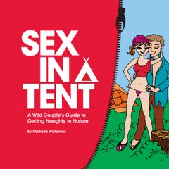
Sex in a Tent - Very Funny Review!
The guys over at Camping Gear TV have reviewed Sex in a Tent. It's definitely R18, so don't watch in front of the kiddies! These guys reminded me of a Wayne's World skit, or maybe even Great White North (for those who remember SCTV).
Anyway, it's pretty entertaining, and apparently the drawing of me at the back of the book looks like Jennifer Grey (pre-nose job) - which I'm taking as a pretty good compliment!
Sit back and enjoy :)
http://campinggeartv.com/2011/09/sex-in-a-tent-a-book-review-for-adults-only-episode-238/
Saturday, August 06, 2011
Cross-Island Walk - Rarotonga, Cook Islands
Rarotonga is a small island in the South Pacific nation of the Cook Islands. It's a popular spot for a beach holiday or a destination wedding, especially for Australians and Kiwis. But for those who can tear themselves away from the sandy shores for a few hours, the island does offer some decent hiking opportunities in its volcanic inland mountains.
The longest and most popular hike is the Cross-Island Walk or "The Needle" (which is the common name for the rock outcrop at the track's highest point.) The full walk takes about 4 hours.
We took on the walk from the town of Avarua to the island's south coast, using Rarotonga's circular bus route to take us close to the trail head. We had to walk inland a couple of kilometres from the main road, but it's an easy walk.
The track itself begins with a walk through a village, where taro, banana and other crops are grown. A power generating station marks the end of the village and the beginning of the "wilderness" portion of the walk. This is also where things begin to head seriously uphill!
The climb up the ridge is quite steep and in wet weather can be very slippery. We found the track relatively easy to follow, as long as you remember that you should be heading uphill at all times.
At the top of the ridge you'll hit a junction. To the right is a short walk up to The Needle, which is worth a look for the views. There is a higher viewing point on the far side of The Needle, but it's tricky to get to so we didn't bother with it.
Once you get past the steep part of the descent, you begin to criss-cross Papua Stream. There are a number of crossings, but for the most part these can be accomplished without getting your feet wet.
The track ends at a waterfall and swimming hole called Wigmore's Waterfall. It's scenic enough, but tends to attract lots of mosquitoes so if you're going to linger, bring repellant.
From the falls, a paved road leads you back to the main road (and bus route). Just as you reach the main road, you'll pass what remains of the failed Sheraton resort that was built many years ago but never completed.
The road will leave you in the village of Vaimaanga, where you can stop at the local supermarket for a well-deserved ice cream cone.
If you're the sort of person who can't lie on the beach every day, this hike will add a bit of variety to your visit to Rarotonga. I don't think it's worth visiting the island just for the walking (there are several other shorter tracks that you can use to walk into the mountains, but must retrace your steps back again) but if you are going for the sun and sand, why not take a day to explore the lush, tropicals foliage and steep peaks.
I highly recommend doing this in the winter (June-August), as scorching summer temperatures and frequent rainfall are likely to make the walk much less pleasant. If you aren't so confident in your hiking skills, you can take a guided hike with a colourful local named Pa. He walks the track three times per week in bare feet!
Monday, April 25, 2011
Coastal Wairarapa
The Wairarapa is a region to the east of the Rimutaka and Tararua mountains. Normally when we head out that way, we go into the Tararuas for some great tramping. But over Easter weekend we decided to keep heading east, all the way to the Pacific coast!
We went for a couple of walks out at Castlepoint, which is about an hour east of the town of Masterton. The beach is popular in summer, but there were quite a few people around enjoying the long weekend and an unusually warm day. There were even a few surfers in the water, later replaced by a few kayakers.
The walk up to the lighthouse is pretty trivial. It's a concrete path, and then some steps. But the rocky area surrounding the lighthouse is fun to explore. The rocky cliffs tower over the pounding surf, making for a dramatic view.
The other main walk in the area takes you up above Deliverance Cove, a sheltered beach where the peace was disturbed by some kids on dirt bikes and ATVs. That was unfortunate, because apart from the noise it's a lovely spot.
The walk follows a ride behind the cove, then climbs a steep hill to the edge of the cliff overlooking the ocean. It towers above the lighthouse and is narrow enough to worry anyone with vertigo.
We were planning to do another walk the next day, called the Honeycomb Rock walk. It's a four hour return walk, which reveals some unusual rock erosion (hence the name) and a shipwreck. But we decided to be leisurely about our long weekend and instead headed to Martinborough for a day of wine tasting. Hey, even hikers enjoy an indulgent day now and then!
Sunday we headed back towards the coast, this time right around the southeast corner of the South Island to a spot called White Rock. We went for a trail ride with some local farmers, which was a real treat. My first ride in around 7 years, and G's first ride in about 25 years!
After that we headed down to the coast itself, and checked out the eponymous White Rock. The sand is black, which makes the limestone boulder seem all the more out of place. It's a deserted and rugged coastal area, at the end of a gravel road. In New Zealand, if you're willing to take a drive an hour or two out of your way you are almost always rewarded with a beautiful coastal scene all to yourselves. (One other car did show up at White Rock as we left, but it was Easter weekend after all!)
So we didn't exactly go for "hard adventure" over our little break, but we did see some remote corners of New Zealand that were definitely worth a peek. And we did come home with a couple of very nice bottles of Martinborough wine!
Saturday, March 19, 2011
Book Review: Little Princes

Normally I limit my reviews on this blog to books, movies or products directly related to outdoor recreation or outdoor adventures. I have made an exception for Little Princes, a memoir by Conor Grennan.
The book slipped into my review list because it is about Nepal, a country so much a part of the hiking and climbing collective consciousness that I can't imagine the outdoors enthusiast who hasn't either visited the country, or put it on their bucket list. (Unfortunately I am still in the latter category.)
When Conor Grennan arrived in Nepal he volunteered at an orphanage thinking it would make his trip around the world sound less self-indulgent. In the end it became a life-changing experience.
This book is inspirational in many ways. When most visitors walk the streets of Kathmandu and see the poverty of the local children, the vast majority think "what a shame" and carry on with their lives. Conor Grennan learned about what was happening to children in Nepal, thought "what a shame" and then thought "I'm going to fix this!"
His efforts to protect trafficked children and reunite them with their families is a testament to what a few determined people can do if they set their minds to it. He had no training for this, no background in international charities, fundraising, politics, or any of the skills that you would think necessary for such an undertaking. His success is simply a story of willpower overcoming self-doubt. He set up a children's home, trekked through isolated valleys into remote villages to locate families, and stood up to powerful traffickers on behalf of those who could not.
So the next time readers of this book see something and think "what a shame", perhaps some of them will also think "I'm going to fix this!" because if Conor Grennan could do it - why not the rest of us!
Thanks Conor, for opening my eyes to the power of just getting on with it!
Little Princes: One Man's Promise to Bring Home the Lost Children of Nepal is not just a memoir - it is also a fundraiser for the charity Conor Grennan created to support this work. So buying this book is one small thing you can do to help. Or you can cut straight to the chase and visit the website for his charity Next Generation Nepal, and make a donation there.