OK, only the Routeburn Track part of our tramp is officially one of New Zealand's "Great Walks", but that's probably a good thing because the cost a fortune! For this one we paid $40 each per night, for 2 nights. (Stay tuned for the REALLY expensive one, the Milford Track.) Then we continued onto the Greenstone track which we can use our Annual Hut Passes for.
In all, we spent 5 days and 4 nights on the trails. The tracks cross between Mt. Aspiring National Park, Fiordland National Park, and the Greenstone Conservation Area. This part of New Zealand is normally very rainy, so we counted ourselves lucky to be dry 4 days of the 5.
 The Routeburn is considered by many to be the most scenic walk in the country. While I haven't done all of the others for comparison, I would agree that the scenery is exceptional. The walk is also very well maintained, so that people with little experience in the back country can still accomplish it. A bit of fitness and skill is necessary, but very little compared to the average New Zealand tramp. All significant streams are bridged, so there's no need to cross through water. It's nearly impossible to lose the track. The huts have gas cookers and flush toilets. It's pretty luxurious as tramping goes. (For the ultimate luxury, however, you can do it as a guided walk, stay in huts with real beds and hot showers, not have to carry your own food, and have someone making sure you're OK - but that costs over $1000.)
 The first day is 3-4 hours, mostly in the bush, walking through beech forest following the river. The river is one of those remarkable turquoise mountain streams, crystal clear and stunning. It only came into view now and then, but I made sure to break out the camera and try to capture it. The last hour or so is an uphill climb to the Routeburn Falls Hut. It sleeps 48, and was probably full that night. The warden gave G and I instructions to a side track, since we were there around 1:30pm. It's now an unmarked track, since I guess the Dept. of Conservation was worried about too many inexperienced trampers getting into trouble. It's a steep and rocky climb up to a peak with a muddy-looking lake. Around the other side of the peak you can look almost straight down onto the hut. It was a tiring climb, but a very nice view. And after all, there's only so long you can spend sitting around a hut! (Even a very nice hut.)
The hut had one great feature - it was built on stilts above the forest floor which not only provided great views from the balcony, but also seemed to keep the sand flies away so we could sit outside and enjoy the view!
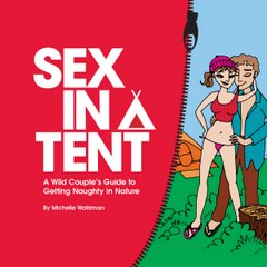
We chatted with the warden that night about "Sex in a Tent" (he offered to put up one of my promotional postcards on the notice board in the hut) and he told me a great story about some comments he found in the hut's visitor book. A group of people had spent the night and the next morning one wrote "Hut sex was great." The next line down another wrote "Hut sex was amazing!" And on the third line someone else wrote "Lighting conditions in the hut were poor for filming." Hilarious! Anyway, I can't imagine there's much sex going on during the summer season, with the bunkrooms packed every night. If you want to have some privacy, you pretty much have to bring a tent and stay at the campgrounds instead of the huts.
 Day two was the saddle day. So we began with a rocky climb, which was hard on the feet and knees. Some lovely views back down the valley made it worthwhile. After about 1 1/2 hours we reached Harris Saddle, where a large shelter is provided. There's a side trail up a peak called Conical Hill, which gives a view all the way out to the Tasman Sea on a clear day. Despite patchy cloud, we made the steep climb up. (At least we could leave our packs at the shelter!) The view was pretty good, but had I known that I'd get an almost identical view from the track itself later on, I don't know if I would have bothered.
 From the saddle, the track sidles along the hillsides for a long time. This made it tricky to find a place to pop off the trail and have lunch. Eventually a stream provided a small spot for us to sit a while. The views were eventually of the Hollyford face, where down below runs the road up the Hollyford Valley. In time we rounded the edge of the ridge, and got our first view down to Lake McKenzie, and the hut of the same name.
The lake is gorgeous blue-green, and there were many photos taken. The view is a bit of a tease though, because the descent to the hut took almost another hour. By this time (about 6 hours of walking including the side trail) my feet and knees were most unhappy with me. The hut was another deluxe one, but this time the sand flies had access to us! The warden gave a talk that evening about the history of the track, and told some funny stories about the situations they come across from time to time. (Basically, you'd be amazed at how stupid/ignorant some people are on this track.)
 The final day on the Routeburn featured some glorious waterfalls. The star of the show is Earland Falls, which tower above the track and provide a great rest stop. Other falls also feature, some tall and misty, others powerfully gushing over rocks.
The final day on the Routeburn featured some glorious waterfalls. The star of the show is Earland Falls, which tower above the track and provide a great rest stop. Other falls also feature, some tall and misty, others powerfully gushing over rocks. 

There is another hut 3 hours along, called Howden Hut, which some people stay in the first night if they are walking the track in the opposite direction. It's only an hour from the road end, so there's not much point staying there if you are walking out, unless you want to coordinate with an early transportation pick-up. (The trail is one-way, and the two ends are very far apart by road, so you need some kind of shuttle service to take you back to your car or to the next town if you don't have your own car.)
But we weren't going to the road end, so we had a bite of lunch at the hut, and then continued onto the Greenstone Track. It was almost immediately apparent that we were no longer on a "Great Walks" track. Streams had to be crossed without bridges, and the gravel that had covered most of the Routeburn track was gone (for which my feet were actually quite thankful.)

The Greenstone is one of a few tracks you can take that loop around almost back to the beginning of the Routeburn. It follows the Greenstone River all of the way along, so it's a pretty flat route and can be done in any weather. After two more hours of walking we arrived at McKellar Hut. It was back to basics, using our own stove an a regular outhouse. But it's quite a large (16 bunk) hut, so it must get a lot of use. The forecast was for heavy rain and strong winds the next day, so we were not looking forward to that, especially since we had around 15-16 km to cover! Of course I probably shouldn't grumble about that. One guy at the hut was in the process of walking down the entire South Island. He'd done the entire Routeburn Track, the 6 km to McKellar Hut, and 12km more, all that day! His pack was very heavy too - something like 20kg. (I think most of that is food.) Sounds a bit crazy to me, but he seemed to be doing well.
The rain started overnight, but in the morning it was only drizzle. We set out to cover as much ground as possible before things got any worse, and for the first couple of hours the light drizzle was not a problem. We followed the valley enjoying the mossy beech forest (with lichens literally dripping from some of the trees) and occasionally sharing the valley floor with grazing cows. Just before noon the rain started getting more persistent, and things got muddier. I managed to slip on a muddy rock (as G says, it's not a proper tramp until I fall over, soak my feet in a stream, or step in deep mud) and fall over. I caught myself before going right down, but after I got up I realised that when I put my hand down to balance myself I put it in a pile of cow shit! This did nothing to improve my mood. It was lunch time and I was walking around with e-coli bacteria all over my hands! I grumbled for the next 45 minutes to a swing bridge across a large stream. Being a conscientious person, I tried to cross without holding onto the cables, so that I wouldn't spread shit all over them for other people to touch. But in the process, I snagged the back of my hand on a bit of wire, and scraped it. So now I had an open wound on my shit-covered hands!
We stopped for lunch on the veranda of a guided walks hut. (They keep their huts locked.) I washed my hands as well as I could at an outside tap, and let G do all of the food handling just in case. It was now raining steadily, and getting windy. We carried on for another 2 hours to Greenstone Hut, which was very new and well set up. Flush toilets, even! Someone had left a sliver of soap by one of the sinks, so I had a good scrub to get anything remaining off my hands.
There was a hut warden there who told us that a deer hung out just behind the hut and let him pet it sometimes. Hunting on the South Island is seasonal, so the deer are left alone during the summer. But this one is clearly way too trusting and will probably be the first one to go once the season opens! Both hunting and fishing are popular in the Greenstone area, with lots of trout in the rivers and deer in the woods. (Neither of which are native to New Zealand, by the way.)
 In the morning I actually saw the deer grazing outside the hut and snuck outside to grab a few pictures. It had rained heavily overnight, but it seemed to be over for the time being. We had just a 4 hour walk to the road end, and our shuttle wasn't coming until 2pm so it was quite a leisurely walk. I took yet more waterfall pictures, and tried to get a picture of G communicating with a little bird on the track. We kept coming across these little birds (South Island Robins) that are very curious and unafraid of people. They'll pretty much hop right up to you, staying about arm's length away.
 In all it was a very enjoyable tramp, although by the end I was happy to see a hot shower and some clean clothes! And so ends a long post about a long tramp. Next week it's the legendary Milford Track. Crossing my fingers for decent weather on the "wettest walk in the world."
But we weren't going to the road end, so we had a bite of lunch at the hut, and then continued onto the Greenstone Track. It was almost immediately apparent that we were no longer on a "Great Walks" track. Streams had to be crossed without bridges, and the gravel that had covered most of the Routeburn track was gone (for which my feet were actually quite thankful.)
The Greenstone is one of a few tracks you can take that loop around almost back to the beginning of the Routeburn. It follows the Greenstone River all of the way along, so it's a pretty flat route and can be done in any weather. After two more hours of walking we arrived at McKellar Hut. It was back to basics, using our own stove an a regular outhouse. But it's quite a large (16 bunk) hut, so it must get a lot of use. The forecast was for heavy rain and strong winds the next day, so we were not looking forward to that, especially since we had around 15-16 km to cover! Of course I probably shouldn't grumble about that. One guy at the hut was in the process of walking down the entire South Island. He'd done the entire Routeburn Track, the 6 km to McKellar Hut, and 12km more, all that day! His pack was very heavy too - something like 20kg. (I think most of that is food.) Sounds a bit crazy to me, but he seemed to be doing well.
The rain started overnight, but in the morning it was only drizzle. We set out to cover as much ground as possible before things got any worse, and for the first couple of hours the light drizzle was not a problem. We followed the valley enjoying the mossy beech forest (with lichens literally dripping from some of the trees) and occasionally sharing the valley floor with grazing cows. Just before noon the rain started getting more persistent, and things got muddier. I managed to slip on a muddy rock (as G says, it's not a proper tramp until I fall over, soak my feet in a stream, or step in deep mud) and fall over. I caught myself before going right down, but after I got up I realised that when I put my hand down to balance myself I put it in a pile of cow shit! This did nothing to improve my mood. It was lunch time and I was walking around with e-coli bacteria all over my hands! I grumbled for the next 45 minutes to a swing bridge across a large stream. Being a conscientious person, I tried to cross without holding onto the cables, so that I wouldn't spread shit all over them for other people to touch. But in the process, I snagged the back of my hand on a bit of wire, and scraped it. So now I had an open wound on my shit-covered hands!
We stopped for lunch on the veranda of a guided walks hut. (They keep their huts locked.) I washed my hands as well as I could at an outside tap, and let G do all of the food handling just in case. It was now raining steadily, and getting windy. We carried on for another 2 hours to Greenstone Hut, which was very new and well set up. Flush toilets, even! Someone had left a sliver of soap by one of the sinks, so I had a good scrub to get anything remaining off my hands.
There was a hut warden there who told us that a deer hung out just behind the hut and let him pet it sometimes. Hunting on the South Island is seasonal, so the deer are left alone during the summer. But this one is clearly way too trusting and will probably be the first one to go once the season opens! Both hunting and fishing are popular in the Greenstone area, with lots of trout in the rivers and deer in the woods. (Neither of which are native to New Zealand, by the way.)
In the morning I actually saw the deer grazing outside the hut and snuck outside to grab a few pictures. It had rained heavily overnight, but it seemed to be over for the time being. We had just a 4 hour walk to the road end, and our shuttle wasn't coming until 2pm so it was quite a leisurely walk. I took yet more waterfall pictures, and tried to get a picture of G communicating with a little bird on the track. We kept coming across these little birds (South Island Robins) that are very curious and unafraid of people. They'll pretty much hop right up to you, staying about arm's length away. In all it was a very enjoyable tramp, although by the end I was happy to see a hot shower and some clean clothes! And so ends a long post about a long tramp. Next week it's the legendary Milford Track. Crossing my fingers for decent weather on the "wettest walk in the world."
 We walked in along the West Matukituki Valley, following the pale blue river upstream for about 9km. It's a fairly easy walk, although the cows grazing the valley floor do leave a lot of stinky obstacles behind!